Best Hikes in Vatnajökull National Park


How to Get to Vatnajokull National Park?
Vatnajokull National Park is located in the southern-eastern part of Iceland, about a 4-hour drive away from the capital Reykjavik. It is easily accessible by any type of car by the pathed road.
Reykjavik to Vatnajökull National Park map:
5 Best Hikes in Vatnajökull National Park
1. Svartifoss Waterfall Hike
Distance: 5.5 km
Duration: 2 hours
Difficulty: Easy
Hike up to Svartifoss waterfall, which is the most popular trail in Skaftafell. Black hexagonal basalt columns frame this picturesque waterfall. Its name, translated in English, is "Black Falls."
The Svartifoss trail begins at Skaftafell Visitor Center. In the beginning, the incline is quite steep but well-maintained. The hike takes around 40 minutes one way. If you're looking for something more, the alternatives could be going to the nearby Sjónarsker viewpoint and stopping by the old farm Sell on the way back. If you want to visit all of the three sights—Svartifoss, Sjónarsker, and Sel—it will take around 2 hours (approximately 5.5 km) for a round trip.

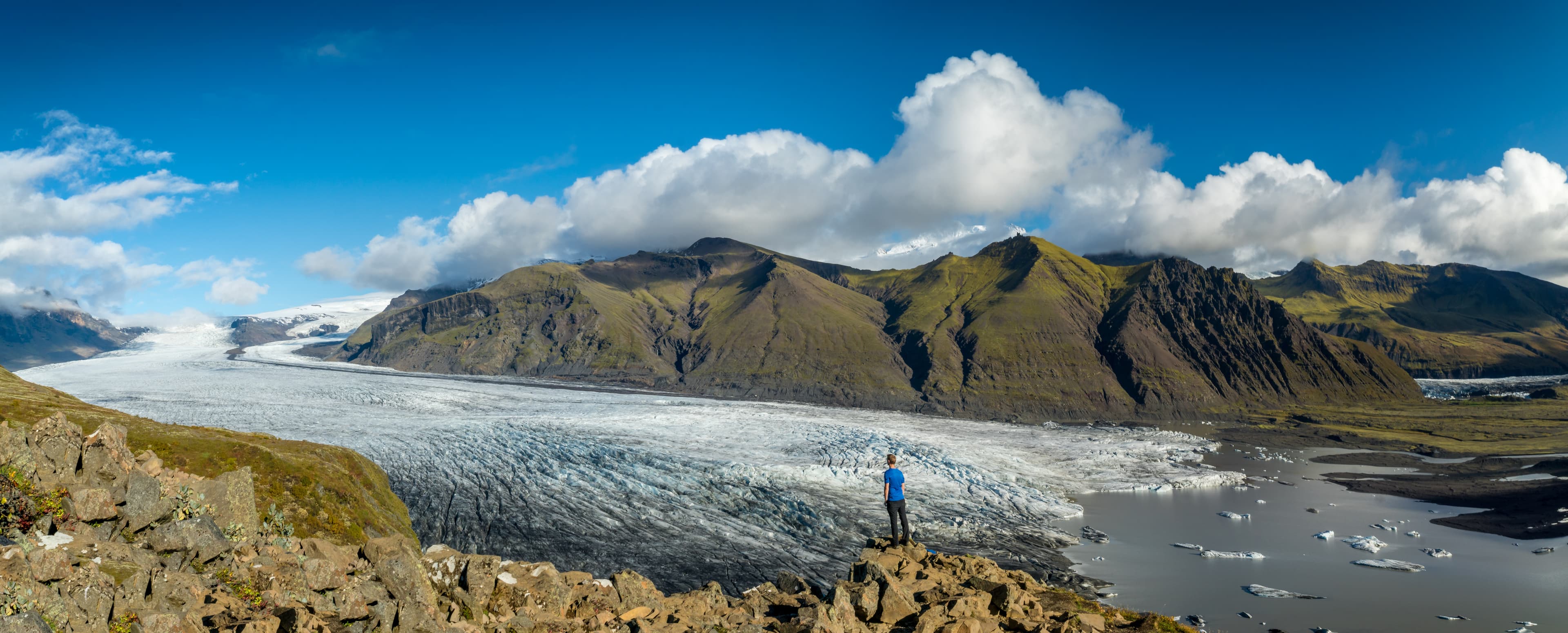
2. Skaftafellsjökull Glacier
Distance: 3.7 km
Duration: 1-1.5 hours
Difficulty: Easy
The hike to the base of the Skaftafellsjökull glacier tongue is probably the easiest trail in the area. What's great about this trail is seeing glaciers from different perspectives. The route is relatively easy, with flat ground, for the most part, paved for one part, and gravelly for another part of the way. You'll get close to the glacier's tongue base at the end of this track and see it very well.
Remember that going on a glacier is only recommended accompanied by a certified glacier guide. You can book glacier hiking tours here or check out this Vatnajökull Glacier hike.

3. Sjónarnípa Viewpoint
Distance: 6.4 km
Duration: 2-2.5 hours
Difficulty: Moderate
The trail leading to the Sjónarnípa viewpoint is Iceland's second most popular trail. Hikers are rewarded with a fantastic view of the Skaftafellsjökull glacier tongue from this viewpoint. You can even see all the way back to where the ice spills and retreats year by year, leaving glacier lagoons behind.
The trail begins the same way as the Svartifoss hike, but there's a turn before it. Coming from the viewpoint, it leads directly to the visitor's center. There's a thrilling trail along the edge of the cliff on the way back through a small forest. This hiking route is around 6.4 km long, and it will take approximately 2-2.5 hours to finish.
4. Morsárjökull Glacier
Distance: 20.9 km
Duration: 7 hours
Difficulty: Difficult
This trail is perfect for those ready for a bit of a challenge. The Morsárjökull Glacier is located in the northwest part of the Skaftafell, farther up north than Skaftafellsjökull. It's also one of the few places in Iceland where you can see that glaciers are actually disappearing. The retreating glacier is uncovering the jagged mountain peaks.
This trail heads west from the Skaftafell visitor's center to the 10-kilometer-long Morsárdalur valley, covered with glacial streams. The trail goes through the rough black sand to the Morsárjökull glacier tongue. Here you can see the glacial lake in front of the glacier. You can also get a view of the Morsárfoss waterfall from the distance. The entire hike is around 20.9 km long and can be done in approximately 6-7 hours. This trail is considered difficult and is recommended for experienced hikers.

5. Kristínartindar Mountain
Distance: 17.9 km
Duration: 7-8 hours
Difficulty: Difficult
A hike up to Kristínartindar Mountain is another trail suitable for more experienced hikers. The hike is considerably difficult, but hikers get rewarded with an exceptional view over the Vatnajokull at the top of the mountain. If the day is clear, you can even get a view of the tallest waterfall in Iceland, Morsárfoss. Morsárfoss is a 240-meter high waterfall which has been revealed in 2007 after the Morsárjökull glacier retreated from the cliffs.

The beginning of the trail is the same as the trail leading to Svartifoss and Sjónarsker's viewpoint. Then, instead of turning back to the visitor's center, you'll need to continue up to the Gemludalur valley. From there, there's a steep hiking trail leading to the top of the mountain. Once you come down from the mountain peak, the trail continues through Gemludalur and brings you back to the visitor center past the Sjónarnípa viewpoint.
Keep in mind that this hike is long (approximately 7-8 hours), and come prepared with enough snacks and drinking water. The toughest part of the hike is climbing the mountain top, so if you want an easier way to explore, you can just continue the hike along the valley after passing the Svartifoss waterfall.
Looking for more breathtaking hikes in Iceland? Check out our ultimate list of the best hikes in Iceland. Also, our one-day and multi-day hiking tours will take you through some of the most beautiful places in Iceland.


